Randonnée Marche Le Louroux - le Louroux - Photo
 fustier
fustier

Utilisateur

© OpenStreetMap contributors
Longueur
Longueur
21 km
Boucle
Boucle
Oui
Date de création :
2019-04-10 08:00:30.205
Dernière modification :
2019-04-16 10:08:17.806

(0 Avis)

Marche
Marche
5h55
Difficulté : Très facile

Scannez ce code QR pour ouvrir la randonnée dans l'application SityTrail

Application GPS de randonnée GRATUITE

Logo SityTrail SityTrail

IGN / Instituts géographiques

Télécharger SityTrail sur l'App Store Télécharger SityTrail sur Google Play

Logo SityTrail SityTrail World

Le monde est à vous

Télécharger SityTrail sur l'App Store Télécharger SityTrail sur Google Play Télécharger SityTrail sur Huawei AppGallery

À propos

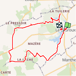
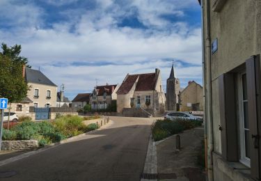
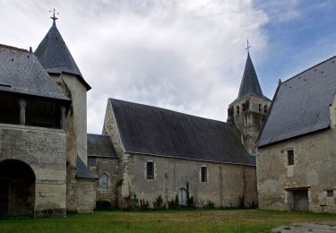
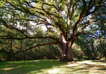
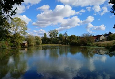
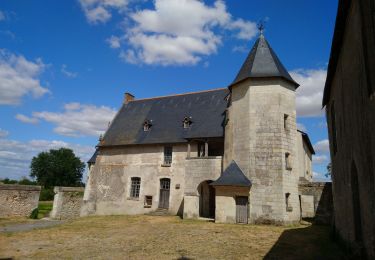
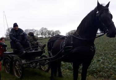
Randonnée Marche de 21 km à découvrir à Centre-Val de Loire, Indre-et-Loire, Le Louroux. Cette randonnée est proposée par fustier.

Description

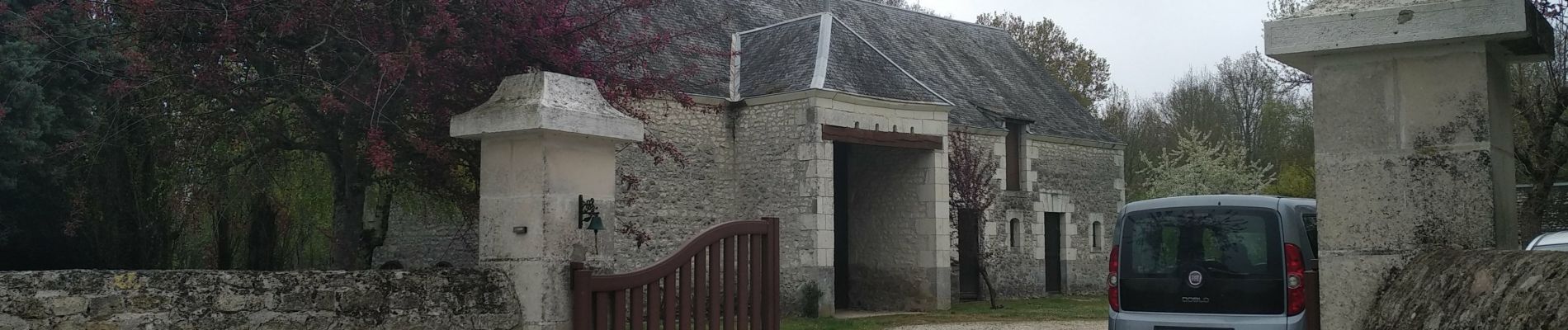
Le Louroux est un espace naturel bien aménagé pour regarder les oiseaux. la randonée ce termine par la visite du prieuré et du moulin dit "banal"

Profil altimétrique

Photos

Localisation

Pays :
France
Région :
Centre-Val de Loire
Département/Province :
Indre-et-Loire
Commune :
Le Louroux
Localité :
Unknown
Départ:(UTM)
332048 ; 5225149 (31T) N.

Randonnées à proximité

Randonnée Marche Le Louroux - le Louroux - variante PR Boucle 2 - 17km 105m 3h45 (45mn) - 2023 09 27 - Photo
Marche
Orcal37

Marche

Facile
Le Louroux, Centre-Val de Loire, Indre-et-Loire, France
17 km | 18,3 km-effort
3h 45min
Oui
Randonnée Marche Louans - Louans - les Trois Chênes - 13.1km 55m 3h00 (40mn) - 2023 09 22 - Photo
Marche
Orcal37

Marche

Facile
Louans, Centre-Val de Loire, Indre-et-Loire, France
13,1 km | 13,9 km-effort
3h 0min
Oui
Randonnée A pied Le Louroux - Étang du Louroux - Photo
A pied
PRO

A pied

Facile
Le Louroux, Centre-Val de Loire, Indre-et-Loire, France
5,5 km | 5,8 km-effort
1h 19min
Oui
Randonnée Marche Louans - Louans - PR Grande boucle - 17.2km 80m 3h30 - 2020 10 10 - Photo
Marche
Orcal37

Marche

Facile
Louans, Centre-Val de Loire, Indre-et-Loire, France
17,2 km | 18,2 km-effort
3h 30min
Oui
Randonnée Marche Tauxigny-Saint-Bauld - Saint-Bauld - La Vallée de l'Echandon - 16.4km 170m 3h35 - 2020 09 26 - Photo
Marche
Orcal37

Marche

Facile
Tauxigny-Saint-Bauld, Centre-Val de Loire, Indre-et-Loire, France
16,4 km | 18,7 km-effort
3h 35min
Oui
Randonnée Marche Le Louroux - Le Louroux - boucle 1 - 20.9km 100m 4h45 (35mn) - 2019 07 28 - Photo
Marche
Orcal37

Marche

Facile
Le Louroux, Centre-Val de Loire, Indre-et-Loire, France
21 km | 22 km-effort
4h 45min
Oui
Randonnée Marche Manthelan - Manthelan - Photo
Marche
danaubrac

Marche

Facile
Manthelan, Centre-Val de Loire, Indre-et-Loire, France
9,2 km | 9,9 km-effort
2h 1min
Oui
Randonnée Marche Tauxigny-Saint-Bauld - St Bauld - Photo
Marche
LEMENIO

Marche

Facile
Tauxigny-Saint-Bauld, Centre-Val de Loire, Indre-et-Loire, France
10,8 km | 11,9 km-effort
2h 38min
Oui
Randonnée V.T.T. Saint-Branchs - Retour sortie ferme bio La Cheptellière - Photo
V.T.T.
Filou37

V.T.T.

Facile
Saint-Branchs, Centre-Val de Loire, Indre-et-Loire, France
11,2 km | 12,2 km-effort
Inconnu
Non


Fermer
Mes abonnements